- Home
- Government
- Departments
- Planning Division
- Historic Preservation in Concord
- Historic Maps of Concord
Historic Maps of Concord
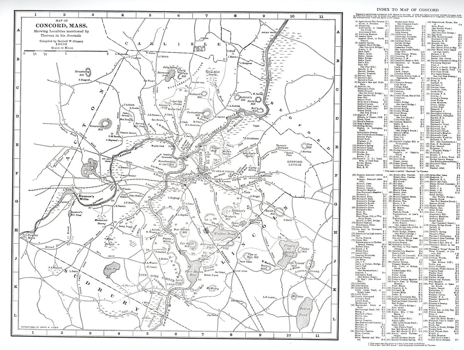
Historic Maps of Concord provide vital information on the evolution of this community and its land, networks and structures. In tracing the history of a building, the following maps are most frequently referenced: 1754, 1830, 1852, 1856, ca. 1871, 1875 (beers atlas), 1889 (walker atlas) and 1906. Late 19th- and early 20th-century Sanborn Fire Insurance Maps provide detailed footprints of buildings in densely-populated, downtown and industrial areas. Here is a helpful key to Sanborn map abbreviations.
1754 Benjamin Brown Survey, Mass State Archives reproduced in recent survey of Barrett’s Mill Rd.
1810-1820 Monument Square, Edward Jarvis, Concord Public Library
1830, John G. Hales, Massachusetts Archives (handwritten annotations)
1830, John G. Hales, Harvard Map Collection (as printed by Lemuel Shattuck)
1852, Henry Francis Walling, Library of Congress
1856, Map of Middlesex County, Henry Francis Walling, Harvard Map Collection
1867 Lake. New York Public Library
Ca. 1871
1875 Beers. Middlesex County Atlas (via Historic Map Works)
Concord, Atlas: Middlesex County 1875, Massachusetts Historical Map (historicmapworks.com)
1878
1889 Walker. Atlas (via Historic Map Works)
1891 Walker Atlas of Massachusetts plate 4, p 51(no details)
1893, Concord Junction, George E. Norris, Normal B. Leventhal Map Center, Boston Public Library
1906, George H. Walker. Atlas of Middlesex County, State Library of Massachusetts vol 2. Under image of atlas, click file under View/Open to download the file. Concord is mapped on plates 40, 42 and 43
1927 Sanborn Fire Insurance Map of Concord Junction not available on line
1927-1947 Sanborn Fire Insurance Map of West Concord not available on line
1946 Town of Concord, Mass. Album of Town Maps…prepared by the Concord Planning Board
Other Maps
1928 A Map of Concord, the Old Musketaquid Plantation, Helen Bodley